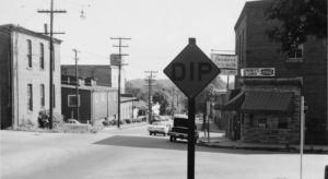
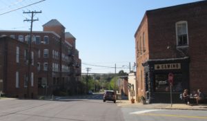
Here are a few more images that show how street views have changed in 50 years in Winston-Salem. The three pairs of images show the area at the intersection of South Marshall Street, Brookstown Avenue, and Wachovia Street. Camino’s Bakery is at the right in the first “Now” image. When the older photo was taken, this space was occupied by Nancy’s Lunch. Also, notice that the Meridian Restaurant and the Tar Branch Towers are at the left in the “Now” image. The new building replaced several industrial buildings, including one on the corner that once housed an ice plant. The old Fries power house can be seen in both images at the left.
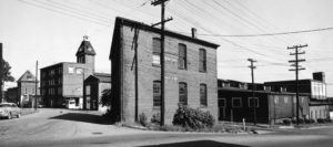
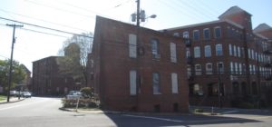
The two images below show the views from the opposite direction, looking north on South Marshall Street. The Mill at Tar Branch is shown at left in the “Now” photo. One feature of the street is noted in the signs that warn of a “Dip” in the street in the older photos.
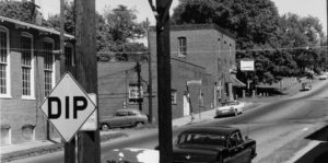
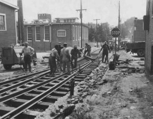
The photo below explains why there were signs warning of a “Dip.” Railroad tracks ran along Wachovia Street. The photo was taken in 1967 when construction was being done on the “bumps” near the tracks, to help with the dip problem. Eventually the tracks were removed (or covered).
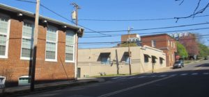
The street views below show Brookstown Avenue at South Marshall Street, looking toward the Brookstown Inn and the Winston-Salem Visitor Center. The Fries power house is near the center of both photos. Meridian Restaurant and Tar Branch Towers are at the right in the “Now” photo. The old ice plant can be seen in the “Then” photo.
Black and white photographs courtesy of Forsyth County Public Library Photograph Collection.
Color photographs by Molly Grogan Rawls.
Stay tuned for the next historical post on May 15th: Winston-Salem Places – Then and Now. Part 3.


Somewhere I’ve seen a photo of a locomotive coming up Wachovia toward Brookstown. The track was not visible in the photo and I thought, “What in the world? …”